![]()
![]()
![]()
![]()
![]()
Abstract
|
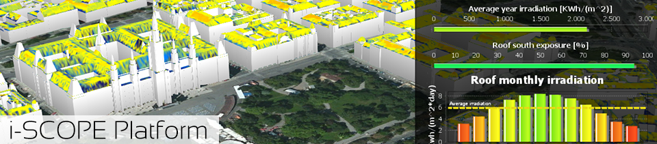
The latest generation of 3D Urban Information Models (UIM) can be used to create smart web services based on geometric, semantic, morphological and structural information at urban scale level, which can be used by local governments to:
Based on interoperable 3D UIMs, i-SCOPE delivers an open platform on top of which it develops, within different domains, three 'smart city' services. These will be piloted and validated, within a number of EU cities which will be actively engaged throughout the project lifecycle. The services will address:
|
Type of Project- Competitiveness and Innovation Framework Programme - ICT Policy Support Programme - Objective identifier: 5.1 - Open Innovation for Internet-enabled services in 'smart' cities' - Pilot Type B Responsible INFSO Unit- F4 New Infrastructure Paradigms and Experimental Facilities Project Start Date- January 2012 Duration- 44 months |
Project Funding
CIP / ICT PSP of the European Commission
Open Innovation for Internet-enabled Services in Smart Cities
Supported by 67 Cash
![]()
![]()
Project Coordinator
Dr. Raffaele De Amicis
Fondazione GraphiTech, Director
Via alla Cascata, 56/C
38123 Trento – Italy
Office: +39 0461 283395
Fax: +39 0461 283398
Mobile: +39 331 610 45 69
http://www.graphitech.it